
Food
environment
Assessment
Community and Market Mapping Tool
Overview
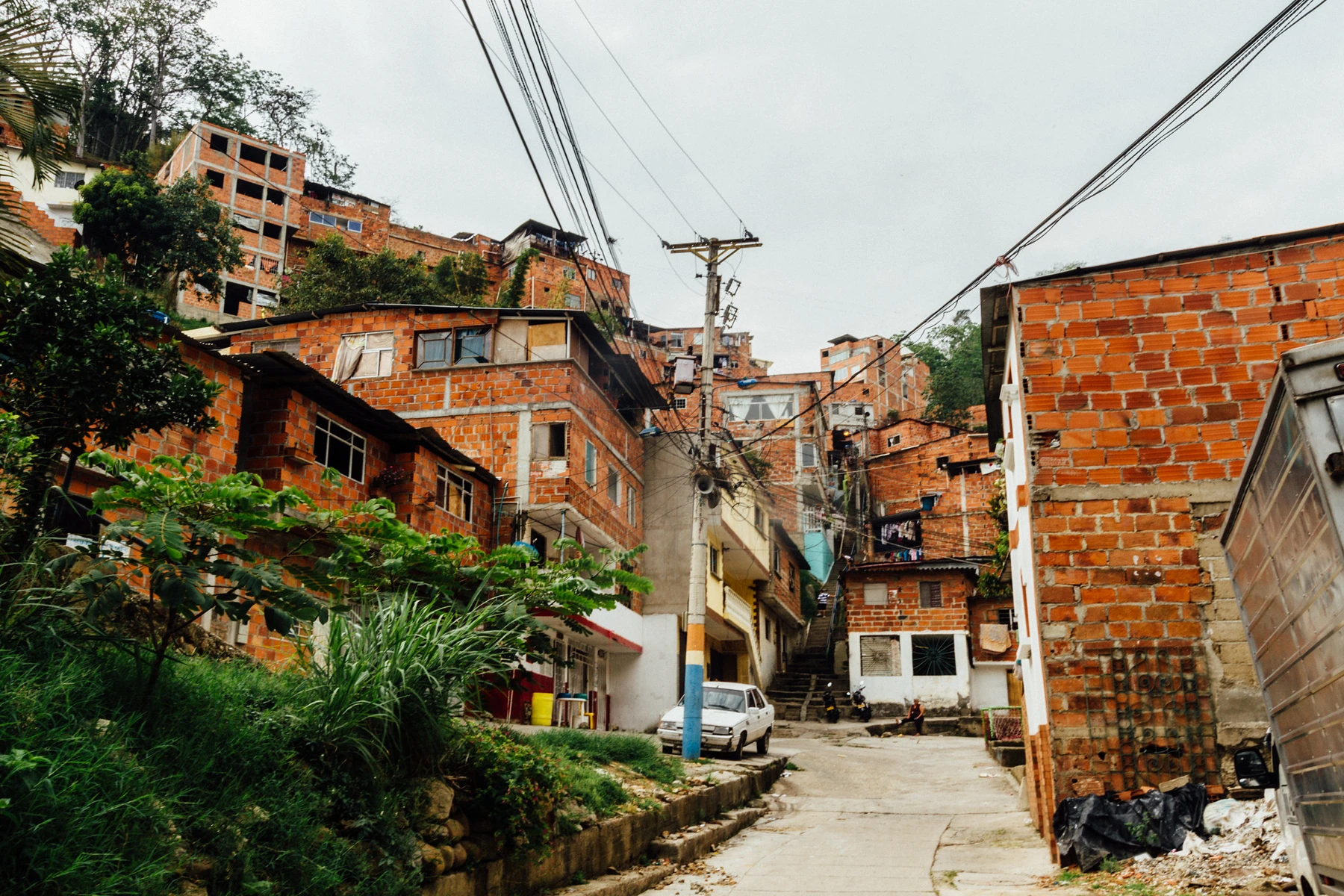
The Community and Market Mapping Tools are used to explore the availability and physical accessibility of food at the neighborhood-scale. The community mapping component gathers data on all food outlets present in a given community, while the market mapping component gathers data specifically in markets with multiple vendors (e.g. open-air traditional markets or farmers markets). These data can be used to explore how outlets and food sources are distributed throughout communities, and the implications this may have for food access and diet outcomes. In the literature, this is often referred to as the ‘community food environment’ (Glanz et al., 2005).
Depending on study design, the tool can enable:
- Identification of areas within the study communities where physical access to healthy food groups is low (‘food deserts’), and areas where this coincides with unhealthy food groups being highly concentrated (‘food swamps’);
- Identification of possible inequities in availability and physical access to healthy/unhealthy food groups between different types of neighborhoods (e.g., by urbanicity or socio-economic makeup); and
- Exploration of possible links with food purchasing and diet outcomes.
This guidance is adapted from The Food Environment Toolbox[1], specifically the Community Food Environment Mapping Tool and the Market Mapping Tool (Downs, Staromiejska, et al., 2024). If there is interest in assessing marketing and advertising outdoors, this guidance can be combined with the Food and Beverage Promotion Tool[2].
[1] The Food Environment Toolbox encompasses a suite of assessments designed to measure different dimensions of the food environment in LMICs. The toolbox is available through the Rutgers University website (https://sites.rutgers.edu/food-environment-Toolbox/), and was funded through the Innovative Methods and Metrics for Agriculture and Nutrition Action (IMMANA) program.
[2] The Food Environment Toolbox includes a Roadside Food and Beverage Promotion Tool that can be used as a stand-alone tool, or integrated with the Community Food Environment Mapping Tool.

Rationale
These mapping tools can enhance understanding of the complex spatial dynamics of food access, especially when paired with data on consumers’ locations and other factors. Evidence from high income countries suggests an association between community food environments and dietary habits, but studies in low- and middle-income countries (LMICs) are still few (Ni Mhurchu et al., 2013). Of these, several have found diet and nutrition outcomes to be associated with density and proximity to vendors (Turner et al., 2019).
Complementary to the enumerator-based methods utilized in this tool are other community participatory methods of mapping food environments, including how they are perceived and experienced by both consumers and food vendors. For example, a study in Nairobi gathered spatial data on food vending locations and food safety risk hotspots, then explored community perceptions and narratives using focus group discussions (Ahmed et al., 2019). Other qualitative methods such as Photovoice and story maps, among others, are part of a growing inventory of tools to gather in-depth information about how individuals experience their food environments (Neve et al., 2021).
The Food Environment also recommends conducting a participatory mapping exercise, wherein focus group discussions are used to draw a map of the community’s food environment, including food outlets that are commonly used, which is meant to spark a discussion about why they are used and which foods they supply. This can be a useful formative step to gather information that is helpful in designing sampling procedures and survey tools for census and in-depth assessments. Guidance for this Participatory Mapping Tool are provided on The Food Environment Toolbox website here.
Type of data
The Community and Market Mapping Tools gather geospatial data on food outlet and open-air market locations, complemented with information about vendor characteristics (e.g., vendor typology, level of permanence), and the availability of different food groups. In order to facilitate large sample sizes, which are likely needed in densely populated urban areas, questionnaires are typically abbreviated in length and should be tailored to study objectives. In order to accommodate these shorter-length surveys, the tools typically inquire only about the availability of food groups in contrast to the In-Depth Vendor Assessment – Availability Tool, which assesses the availability of individual items.
Indicators
Most indicators of physical access can be categorized as density- or distance-based. However, these can be measured at different levels, including the individual/household-level, school or other institution-level, or at the sampling unit-level (or some other geographic area). When household location data is accessible, indicators at the individual- or household-level may more accurately reflect individual circumstances and variation of food access within communities. Indicators can also be disaggregated by outlet types or food group offerings (e.g. density of outlets selling vegetables around households).
Data from the Community and Market Mapping Tools can be used to generate indicators like the following, which is a non-exhaustive list:
Density of outlets in a geographic area
A count of outlets is the most simple variable that can be generated from community and market mapping. This can be converted to a density indicator when divided by geographic area, such as the neighborhood or sampling unit’s area. Counts and density can be disaggregated by vendor typology or food group offerings, if there is a particular food group of interest. A higher density of outlets is hypothesized to imply greater availability and access to food.
Density of outlets surrounding individuals, households, or schools
This indicator is similar to the previous indicator, but applied to buffer zones around households. The appropriate distance for these buffer zones may be context-dependent, based on how urbanized or densely populated the area is, and how far people typically travel for food, among other factors. The same analysis can be used to examine food environments surrounding schools or other institutions.
Distance from household to nearest outlet
This indicator attempts to assess ease of access from households to outlets, assuming shorter distance provide better access. Distance-based measures should incorporate road networks, especially in urban areas, where Euclidean (‘as the crow flies’) distance measures may overestimate accessibility.[3]
Travel time from household to nearest outlet
If additional data on modes of transportation used by individuals are available, it is possible to estimate travel times, which may generate more realistic measures of accessibility, especially in contexts where driving or using public transportation to access food outlets is common (Charreire et al., 2010). Application programming interface (API) tools are now available that allow data analysis software to communicate with mapping software (e.g., Google Maps) in order to more easily retrieve travel time estimates (e.g., the ‘mapsapi’ package for R Studio (Dorman, 2023)).
Ratio or proportion measures of healthfulness
Ratio or proportional measures attempt to summarize the healthfulness of community food environments. Common examples are: the percent of fast-food vendors in a community (out of the total number of vendors), or ratio of healthy to unhealthy vendors. However, caution should be exercised for a couple reasons: 1) ratios and proportions may make communities look similar that differ substantially in their absolute counts; and 2) binary classification of “healthy” and “unhealthy” vendors may oversimply food offerings and mask heterogeneity within outlet types (Thornton et al., 2020). Furthermore, classification of food outlets and even individual food items as healthy or unhealthy can add significant complexity (see box below).
[3] Density-based indicators provide insight into ease of access, like distance-based indicators, but factor in all of the outlets within a short distance of households rather than one, so may give a better sense of general availability in the immediate vicinity of households. In contrast, distance or time-based measures may make sense in terms of reaching outlet types that are few in number, but potentially very important in terms of their share of household food expenditure – for example in the case of open-air traditional markets or supermarkets.
Classification of foods into healthy and unhealthy groups
Deciding how to categorize individual foods into food groups, and unhealthy versus healthy groups, is a key design decision that should be made when developing and adapting questionnaires. Standardized diet quality metrics have recently emerged that seek to assess consumption of both healthy and unhealthy foods, including the Global Diet Quality Score (GDQS) and the Diet Quality Questionnaire (DQQ). Unhealthy foods are those that contribute to risk of non-communicable diseases (NCDs) and should thus be limited. The GDQS, which also tracks information on quantities consumed, contains a third group: foods that are unhealthy only if consumed in excess quantities. Below is a list of the food groups included in each of the three GDQS categories:
| Healthy food groups | Unhealthy food groups | Unhealthy if consumed in excess |
|---|---|---|
| Citrus fruits, deep orange fruits, other fruits, dark green leafy vegetables, cruciferous vegetables, deep orange vegetables, other vegetables, legumes, deep orange tubers, nuts and seeds, whole grains, liquid oils, fish and shellfish, poultry and game meat, low-fat dairy, eggs | Processed meat, refined grains and baked goods, sweets and ice cream, sugar-sweetened beverages, juice, white roots and tubers, purchased deep-fried foods | High fat dairy Red meat |
While GDQS and DQQ are meant to assess food consumption, they are also useful classification systems for foods in the food environment. INFORMAS provides another suggested food categorization that focuses on separating healthy/core food groups from unhealthy/non-core food groups, but this may require further contextualization at country level. At a minimum, classification should aim to identify energy-dense, nutrient poor foods that would not be considered a core part of a healthy diet (Kelly et al., 2013).
Pros
- Market and food outlet listings generated can serve as a sampling frame for further in-depth assessment of other food environment dimensions.
- Mapping of outdoor food advertising can be combined with this tool in order to gather geospatial data on advertisements and outlet locations simultaneously (see Food and Beverage Promotion Tool).
Cons
- The geographic boundaries of “community” sampling units (e.g. census tracts, neighborhoods) may not accurately delineate the context in which individuals procure their food. This spatial uncertainty can mischaracterize food environment exposures and their possible role in restricting or enhancing food access.
- Food accessibility is also influenced by the modes of transportation that individuals can use, which requires additional data from household surveys to assess.
Tool and indicator validation
Similar tools as that described have been tested in urban, peri-urban, and rural settings of India and Cambodia as part of the development of the Food Environment Toolbox, and by USAID Advancing Nutrition in Honduras, Liberia, Nigeria, and Timor-Leste (Downs et al., 2025; Downs, Warne, et al., 2024). These pilot experiences did not formally assess validity or reliability, but gauged feasibility based on field experiences of enumerators and refined the tools accordingly. Geospatial measures of food availability and access such as those generated by this tool are commonly used in food environment research, but their validity may be limited if geographically proximate areas do not reflect the activity space in which people move to procure food. This may especially be the case in urban contexts, where consumers may leave their neighborhood for work. Formative information gathering can help to refine study designs and sampling strategies to account for these uncertainties.

Lower-resource adaptations
In settings with limited resources, adaptations to the GDQS tool and data collection methods can help maintain data quality while reducing costs and logistical burdens.
- Purposively sample a smaller set of contrasting urban communities (e.g. middle-income vs. low income)
If using the market mapping tool, assess a more limited range of vendors selling specific food groups of research interest rather than a full census[4] - Shorten questionnaire length by assessing fewer market and outlet characteristics and a shortened (or more aggregated) list of food groups

Higher-resource adaptations
Conversely, in high-resource contexts, expanded data collection and broader geographic coverage can enhance the depth and utility of GDQS findings.
- Randomly sample communities from all urban areas of interest to carry out the mapping exercise in
Assess the availability of an extended list of food groups, aligning to GDQS or DQQ - Leverage mapping of markets and retail outlets to map food advertisements as well
Attempt to capture mobile vendors, by stationing enumerators in central areas where they are known to operate or pass through[5] - Attempt to capture mobile vendors, by stationing enumerators in central areas where they are known to operate or pass through
[4] The Food Environment Toolbox Market Mapping Tool enables users to draw a sub-sample of market vendors, by first asking what types of vendors are available, then sampling a number of vendors from within each type.
[5] The Food Environment Toolbox includes a Mobile Vendor Census, which can be integrated into the Community Food Environment Mapping tool. Additional guidance can be found here.
Sampling and data collection considerations
Sampling procedures should address selection of neighborhoods or communities (the primary sampling unit) and food outlets within the communities. If using the market mapping component, researchers must also select open-air markets for their sample and decide whether to conduct a census of vendors in those markets or assess a smaller sub-sample. For researchers interested in school food environments, primary sampling units may instead consist of schools and their surrounding geographic areas; this may also apply to other types of institutional food environments.
Selection of communities can be random or purposive. A random sample could be drawn from all urban and peri-urban areas of interest, while a purposive sample could focus on specific areas of interest – such as those where a program is being planned or areas that contrast on some feature (such as income level). The definition of “community” varies by setting and may often consist of smaller geographic areas than those delineated by the lowest administrative units, especially in densely populated urban areas.
Selection of markets and food outlets within sampled communities should be as close to comprehensive as possible in order to accurately reflect food availability and access. Prior engagement with community members and key informants is helpful to gather insight into where food outlets are located (e.g. clustered along a main road or intersection, or dispersed throughout the community), which may inform strategies for carrying out mapping.
Other secondary data sources
| Secondary data sources | Pros | Cons | Indicators |
|---|---|---|---|
| Food vendor registration databases Database of open-air market locations | Publicly available from government agencies | May not include informal vendors, and thus should be validated through field observation | Count or density of vendors at community-level Ratio or proportion of vendor types (food group availability data may be unavailable) Individual and household-level measures possible if paired with household location data |
| Online tools (Google Maps, Open Street Maps) | Open access Relatively precise location included (in comparison with public registries) | Likely underestimate the number of vendors present Lack of accurate information on their typology of foods offered |
Illustrative papers that have used similar methods and indicators
Ecological study of the association between socioeconomic inequality and food deserts and swamps around schools in Rio de Janeiro, Brazil (Andretti et al., 2023)
The role of the local retail food environment in fruit, vegetable and sugar-sweetened beverage consumption in Brazil (Duran et al., 2016)
Informal food environment is associated with household vegetable purchase patterns and dietary intake in the DECIDE study: Empirical evidence from food vendor mapping in peri-urban Dar es Salaam, Tanzania (Ambikapathi et al., 2021)
What are possible research questions that could be answered with the
Community and Market Mapping Tool?
- What gaps in food availability and physical access (e.g., measured as density of outlets selling healthy foods) may be impeding the improvement of diets?
- What is the impact of an intervention to enhance physical access to healthy foods?
- What is the relationship between access to healthy (or unhealthy) foods and diets? (requires data on diet quality)
Urban considerations for the Community and Market Mapping Tool
- Urban consumers may be more likely to procure food from outlets outside their neighborhoods if they work away from home or are highly mobile. Formative information gathering should assess the extent to which geographically proximate areas accurately reflect target population’s food environments and adapt sampling strategies accordingly.
- U-PU food environments tend to feature a high concentration of food advertisements as well as food safety risks, in part due to the large number of informal and street food vendors. Therefore, when planning a mapping exercise, researchers may want include food advertisements and food safety risks in their data collection. The temporal dimension of food access may also be important to consider in urban areas – for example, if nearby food vendors operate only during the daytime, but community members are not returning home until the evening, geographic measures may overestimate physical access.
- Mobile vendors and food delivery services are more common in urban areas and may account for larger portion of the local food supply, however, due to their dynamic nature, moving around locations and having hours that can vary from day to day. Knowledge of the level of utilization of these vendors among the target population will enhance study design as well as interpretation of findings. Additional guidance on collecting data from mobile vendors is available in The Food Environment Toolbox Community Food Environment Mapping: Mobile Vendor Census instructions. Recommended strategies include stationing enumerators at key thoroughfares (main streets or junctions, administrative buildings, etc.) during a time known to be active for mobile vendors, asking them to stop so the data collection can be carried out, and offering an incentive if necessary (Downs, Staromiejska, et al., 2024).
Resources related to the Community and Market Mapping Tools
- Charreire, Hélène, Romain Casey, Paul Salze, Chantal Simon, Basile Chaix, Arnaud Banos, Dominique Badariotti, Christiane Weber, and Jean Michel Oppert. 2010. “Measuring the Food Environment Using Geographical Information Systems: A Methodological Review.” Public Health Nutrition. https://doi.org/10.1017/S1368980010000753.
- Downs, S., Staromiejska, W., Bakshi, N., Sok, S., Chhinh, N., Ahmed, S., Fox, E., Herforth, A., & Ghosh-Jerath, S. 2024. “The Food Environment Toolbox: Community Food Environment Mapping Tools: Food Outlet Census.”
- Downs, S., Staromiejska, W., Bakshi, N., Sok, S., Chhinh, N., Ahmed, S., Fox, E., Herforth, A., & Ghosh-Jerath, S. 2024. “The Food Environment Toolbox: Open-Air Market Mapping Tool.”
- Ni Mhurchu, C., S. Vandevijvere, W. Waterlander, L. E. Thornton, B. Kelly, A. J. Cameron, W. Snowdon, and B. Swinburn. 2013. “Monitoring the Availability of Healthy and Unhealthy Foods and Non-Alcoholic Beverages in Community and Consumer Retail Food Environments Globally.” Obesity Reviews. https://doi.org/10.1111/obr.12080.
References
Ahmed, Sohel, Mordechai Haklay, Cecilia Tacoli, Grace Githiri, Julio D. Dávila, Adriana Allen, and Eric M. Fèvre. (2019). “Participatory Mapping and Food-centred Justice in Informal Settlements in Nairobi, Kenya.” Geo: Geography and Environment 6 (1). https://doi.org/10.1002/GEO2.77.
Ambikapathi, R., Shively, G., Leyna, G., Mosha, D., Mangara, A., Patil, C. L., Boncyk, M., Froese, S. L., Verissimo, C. K., Kazonda, P., Mwanyika-Sando, M., Killewo, J., & Gunaratna, N. S. (2021). Informal food environment is associated with household vegetable purchase patterns and dietary intake in the DECIDE study: Empirical evidence from food vendor mapping in peri-urban Dar es Salaam, Tanzania. Glob Food Sec, 28, 100474.
Andretti, B., Cardoso, L. O., Honório, O. S., de Castro Junior, P. C. P., Tavares, L. F., da Costa Gaspar da Silva, I., & Mendes, L. L. (2023). Ecological study of the association between socioeconomic inequality and food deserts and swamps around schools in Rio de Janeiro, Brazil. BMC Public Health, 23(1). https://doi.org/10.1186/s12889-023-14990-8
Charreire, H., Casey, R., Salze, P., Simon, C., Chaix, B., Banos, A., Badariotti, D., Weber, C., & Oppert, J. M. (2010). Measuring the food environment using geographical information systems: A methodological review. In Public Health Nutrition (Vol. 13, Issue 11). https://doi.org/10.1017/S1368980010000753
Dorman, M. (2023, July 21). Introduction to package “mapsapi.” The Comprehensive R Archive Network (CRAN). https://cran.rstudio.com/web/packages/mapsapi/vignettes/intro.html
Downs, S., Staromiejska, W., Bakshi, N., Sok, S., Chhinh, N., Ahmed, S., Fox, E., Herforth, A., & Ghosh-Jerath, S. (2024). The Food Environment Toolbox. https://sites.rutgers.edu/food-environment-toolbox/
Downs, S., Staromiejska, W., Bakshi, N., Sok, S., Chhinh, N., Thou, P., Phorn, N., Chen, T., Ahmed, S., Fox, E. L., Herforth, A., & Ghosh-Jerath, S. (2025). The Food Environment Toolbox: Developing and Piloting a Suite of Tools to Measure Food Environments in Low- and Middle-Income Countries. Current Developments in Nutrition, 9(5), 107444. https://doi.org/10.1016/j.cdnut.2025.107444
Downs, S., Warne, T., McClung, S., Vogliano, C., Alexander, N., Kennedy, G., Ahmed, S., & Crum, J. (2024). Piloting Market Food Environment Assessments in LMICs: A Feasibility Assessment and Lessons Learned. Food and Nutrition Bulletin, 45(4). https://doi.org/10.1177/03795721241296185
Duran, A. C., de Almeida, S. L., Latorre, M. do R. D. O., & Jaime, P. C. (2016). The role of the local retail food environment in fruit, vegetable and sugar-sweetened beverage consumption in Brazil. Public Health Nutr., 19(6), 1093–1102.
Glanz, K., Sallis, J. F., Saelens, B. E., & Frank, L. D. (2005). Healthy nutrition environments: Concepts and measures. In American Journal of Health Promotion (Vol. 19, Issue 5). https://doi.org/10.4278/0890-1171-19.5.330
Kelly, B., King, L., Baur, L., Rayner, M., Lobstein, T., Monteiro, C., Macmullan, J., Mohan, S., Barquera, S., Friel, S., Hawkes, C., Kumanyika, S., L’Abbé, M., Lee, A., Ma, J., Neal, B., Sacks, G., Sanders, D., Snowdon, W., … Walker, C. (2013). Monitoring food and non-alcoholic beverage promotions to children. In Obesity Reviews (Vol. 14, Issue S1). https://doi.org/10.1111/obr.12076
Neve, K., Hawkes, C., Brock, J., Spires, M., Isaacs, A., Gallagher Squires, C., Sharpe, R., Bradbury, D., Battersby, J., Chaboud, G., Chung, A., Conaré, D., Coveney, J., Demmler, K., Dickinson, A., Diez, J., Health, T. G. I. for G., Holdsworth, M., Kimani-Murage, E., … Zorbas, C. (2021). Understanding lived experience of food environments to inform policy: an overview of research methods. Centre for Food Policy, February.
Ni Mhurchu, C., Vandevijvere, S., Waterlander, W., Thornton, L. E., Kelly, B., Cameron, A. J., Snowdon, W., & Swinburn, B. (2013). Monitoring the availability of healthy and unhealthy foods and non-alcoholic beverages in community and consumer retail food environments globally. In Obesity Reviews (Vol. 14, Issue S1). https://doi.org/10.1111/obr.12080
Thornton, L. E., Lamb, K. E., & White, S. R. (2020). The use and misuse of ratio and proportion exposure measures in food environment research. In International Journal of Behavioral Nutrition and Physical Activity (Vol. 17, Issue 1). https://doi.org/10.1186/s12966-020-01019-1
Turner, C., Kalamatianou, S., Drewnowski Adam and Kulkarni, B., Kinra, S., & Kadiyala, S. (2019). Food Environment Research in Low- and Middle-Income Countries: A Systematic Scoping Review. Adv. Nutr.